crossorigin="anonymous">
top of page

Latest posts

Sky pilot Trail in Squamish

Clem Duranseaud
10 hours ago
3 min read

Sky Pilot Trail is a there-and-back hike above Shannon Falls in Squamish. We found it enjoyable, accessible and pretty.


The trailhead is at the top of the Sea to Sky Gondola. You can either access it by taking the gondola or hiking up from the Chief's parking lot. This is what we did a couple of weeks ago when we did the Habrich loop.


Yellow emergency gate blocks a forest road; sign says emergency access gate, no parking 24hrs/day, with evergreens and blue sky.
The gate and the parking lot on the left. You can see our truck parked at the end.
Person beside red SUV with open hatch and door at a mountain campsite, surrounded by evergreens under a bright sunset sky.
Our morning base camp out of the truck. We prefer sleeping at the trailhead instead of waking up at ungodly hours and doing a morning drive.

This time we decided to save our legs 700m of elevation and the gondola fee by going up the access road and parking in front of the gate, 1.5km away from the Summit Lodge.


The access road is steep and can only be done with a 4 x 4.


The first 2 hours of the hike are on a forest road. It's easy and relatively flat. There are a couple of splits that veer off to do other hikes like Goat Ridge and Shannon Basin loop.


At the end of the forest road, you can either go left to the Climber's Route towards Mount Habrich or continue straight on the Sky Pilot trail which turns into a narrower hiking trail.


The turn off for the Climber's Route to Mount Habrich. You can see the summit above the trees.
Backpacker hiking uphill on a rocky forest trail with trekking poles, surrounded by dense evergreen trees and shrubs.
The forest road becomes a cute little hiking trail like this for a maybe a kilometre before entering the steep forest part.

The rest of the Sky Pilot trail is shorter but more technical, going through a small scree and steep forest terrain.


The trail ends on the scree that leads to the Sky Pilot mountain. This is where you can decide whether to keep pushing up toward the summit or take in the views, relax, and head back.

Lone hiker with backpack climbs a rocky alpine valley between steep cliff faces under a gray sky.
The scree that leads to the Sky Pilot glacier. This is where the trail markers ended.
Lone hiker with trekking poles crosses a rocky alpine valley beneath granite peaks and evergreen forest under cloudy sky
Mount Habrich on the other side of the Shannon Basin

We had the intention of summiting Sky Pilot, but the weather was quite cloudy, hiding the summit from view. We decided to push up as high as we could and see what we could do.


We hiked up a scree towards the glacier we had read about. It was a lot smaller than in many pictures I've seen, but whether that was due to global warming or the season, I couldn't tell.


Rocky alpine cirque with steep gray cliffs, patches of snow, and a cloudy sky.
The glacier. Yes, it's tiny. We made our way on the ridge on top of the peaks.
Hiker in a red jacket climbs a rocky, snow-dusted mountain pass under foggy gray cliffs.
On the glacier. It was our first time here and it took us a while to find the right path to scramble up.
Hiker in a red jacket climbs a rocky, snow-dusted mountain pass under foggy gray cliffs.
Going the completely wrong way.

We crossed the glacier, scrambled up another scree and got to the ridge. It snowed briefly, and all the rocks were wet.


We made it to the Pink Slabs amidst fog and humidity. Neither of our scrambling abilities are great, and our rock climbing skills are nonexistent. Pair that with slick rock surfaces and zero visibility, we decided to turn around.

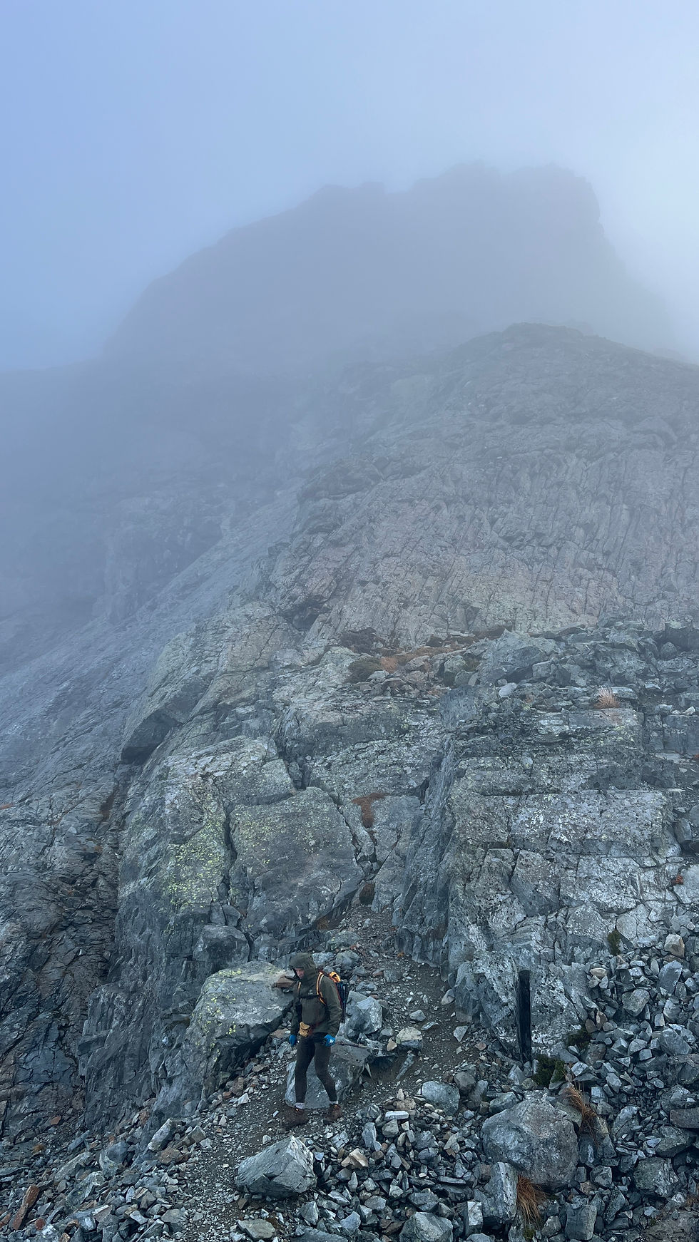
Foggy mountain ridge with rocky foreground and sparse evergreens, the peak fading into mist.
On top of the ridge, with the summit partially hidden by the clouds.
Hiker with backpack climbs a rocky, fog-shrouded mountain trail, surrounded by steep gray cliffs and mist.
The old man hiking down, with the pink slabs mid frame.

This was very frustrating as the summit was tantalizingly close, but neither of us felt comfortable going up. This was also the second summit we missed in as many weeks, but c'est la vie. We'll be back next summer!


We ate our sandwich and headed down. It took us three hours to reach the car.


Foggy mountain ridge with rocky foreground and small evergreens under a pale blue sky, creating a cold, quiet mood.
Pretty sure that's Copilot in the clouds.
Two smiling men sit at a restaurant table with bowls of noodle soup, chopsticks, and sauce bottles by a window at night.
Our dinner the day before the hike at "Taste of Saigon"
Rocky alpine valley with snow patches, forested peaks, and misty clouds under a blue sky.
Views of the glacier from the ridge.
Hiker with trekking poles rests by a stone windbreak on a rocky ridge, overlooking misty blue mountains and a cloudy valley.
There's a wonderful tent spot on the ridge
Happy selfie on the ridge.
Rocky mountain slope with patches of snow under a blue, cloudy sky, overlooking green forested peaks.
Closer view of the glacier

Overall, this was a fun hike. The access to the summit scramble is easy, with most of it on the forest road. It was challenging to find the correct route in the screes, but this shouldn't be a problem with clear, blue sky.


We plan on coming back next summer, to bag Sky Pilot and Copilot in clear weather.


Happy hiking,


Clem


More hiking articles:

Comments

Rated 0 out of 5 stars.
No ratings yet

Add a rating

© 2025 by Clem Fitness.

Clem fitness online personal trainer

Get the latest articles in your inbox

Thanks For subscribing

bottom of page