


Summiting the West lion in vancouver

The Lions are an iconic landmark in the Vancouver scenery. It's on the beautiful Howe Sound Crest Trail that links Porteau Cove and Cypress Mountain.
Last weekend, my dad and I finally climbed to the top of the West Lion, after having reached it's base a few years ago.
Here are the quick details before we dive deeper into it:
Total length (from Cypress): 21km total
Total elevation: 1600m
Total moving time: 8h 45 min
Difficulty: hard, grade 4 scramble is summiting
Where to start to hike the Lions?
We started from the Cypress parking lot.
Technically, the Lions Bay parking lot is closer, but we don't LOVE the trail there, and paying for parking didn't sound appealing to us.
We arrived at Cypress mountain at 7am, beating most of the crowd. I think we must have passed 6 or 8 other hikers on our way to the Lion.
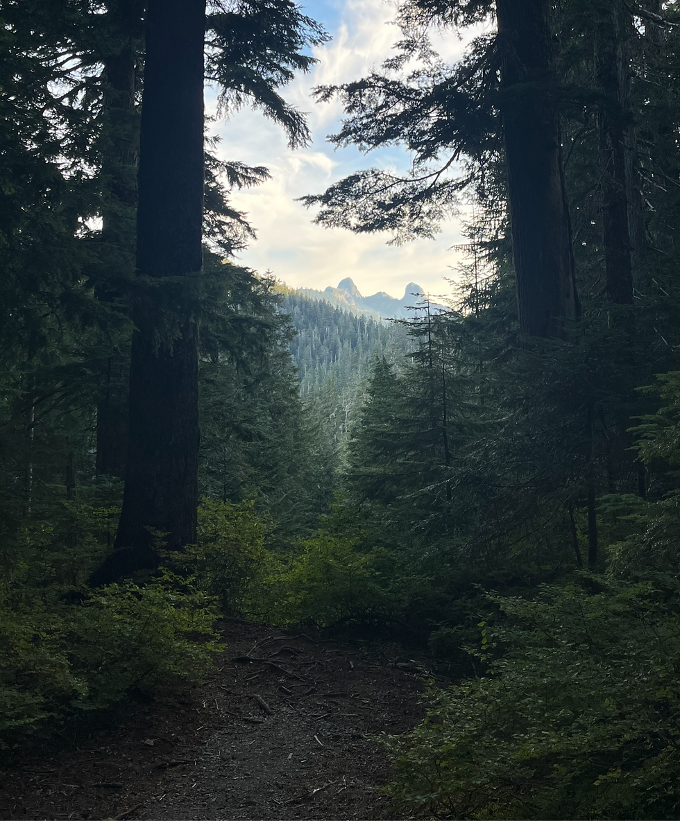
Hiking to the lions from Cypress
Let's be candid here: this is one of the toughest hikes I've done. The trail seesaws up and down the whole time. The elevation between the parking lot (915m) and the summit (1646m) is only 731m.
But the combined elevation of the hike is 1600m, which is, in my opinion, absolutely devastating.
You end up doing three summits:
St Marks
Mount Unnecessary
West Lion
This also makes the way back pretty punishing. Usually, on a normal, sensible hike you go up on the way there and down on the way back. I guess you do get that if you were to start from Lions Bay.
When you hike back from the Lion towards the Cypress parking lot, you still have re-summit Mt Unnecessary and St Mark.
Putting my disbelief aside, this hike offers unmatched views of Howe Sound for multiple hours.
St Mark's Summit
It took us an hour and a half to get to St Mark's, another hour and a half to Mt Unnecessary, and a third ninety minutes to get to the top of the West Lion.
The trail to St Mark is very enjoyable, it's been renovated almost all the way up to the summit, making this part easy to hike on. The elevation gain from the parking lot is only 400m.
St Mark summit is an extremely popular hike in Vancouver. It's easily accessible, relatively easy and offers beautiful views at the end. I recommend going early to beat the crowd. I went there one day during peak time and it was a continuous flow of hikers almost the whole way.

Mount Unnecessary Summit
After the pretty views of St Mark's, you hike down 150m before hiking uphill towards the next summit. There are immediately fewer people on this portion, even during peak times.
The trail isn't renovated; there are a lot more roots and huge steps you have to navigate. An hour after St Mark's, we got out of the trees and were able to enjoy unobstructed views of Howe Sound for the rest of the hike.
I found this section the toughest because it just keeps going up and down. You can also start seeing the Lions, making you feel like you're getting closer, when in fact, there's still a couple hours to go.

Base of the West Lion
Our legs were singing a tale of suffering as we ascended the final ridge. The terrain is a continuation of Mt Unnecessary: very few roots, lots of rocks.
Once you see the weather station, you're almost there.


There are two options at the base of the West Lion:
Go right and continue on the Howe Sound Crest Trail to get to the East Lion, Enchantment Lake, Magnesia Meadows, Brunswick lake and finally Deeks lake
Go left and summit the West Lion

Summiting the west lion on howe sound crest trail
So far, this was a challenging hike. This turns into a scramble to summit the West Lion.
Having lived in Vancouver for most of my life, I've regularly heard of fatal accidents around the Lions. We were both a little nervous, but confident in our skills so we went ahead.
The first technical part came immediately: we had to rappel down two meters of rope. Nothing crazy just yet, but we saw a few people turn back because of this alone.

Then came the grade 3 and 4 scrambles. Most of it has a chain and rope to assist, but a tumble to the right would lead to very serious injuries.

Most of the scramble is very manageable. There was just one more area that made my hair rise a little, but the exposure wasn't as bad where the chain is.
I'm not saying this to discourage anyone from going, simply to give an honest picture of what is there.


Coming back from the Lions
The way back was gruelling. Our legs were smoked from the way there, and having to go up and down those two other peaks didn't make it any easier.
The way there took us 4h 30min, and the way back took us 4h 15min.
Final verdict on this hike
It is a very challenging hike. The time spent on your feet alone (almost 9 hours) is hard.
The combined elevation is brutal.
The views are stunning.
Summiting the Lion requires navigating a grade 4 scramble and comfort with exposure.
More hiking articles:
Cheerio lads,
Clem


Comments